RV Resources · Apps · 50+ apps checked
Best RV Apps for Planning, Traveling & Camping
The RV apps worth keeping on your phone in 2026, grouped by the job they actually do — from RV-safe routing that respects your height and weight to the handful that still work with no bars. Every name, platform and pricing model checked against the developer’s own listing.
RV-safe routing
5 apps
Compared side by side
Work offline
16 apps
Developer states offline use
Categories
8 groups
Sorted by the job
Dropped this year
4 apps
Gone, merged or stale
Names, platforms and pricing last checked October 2, 2026
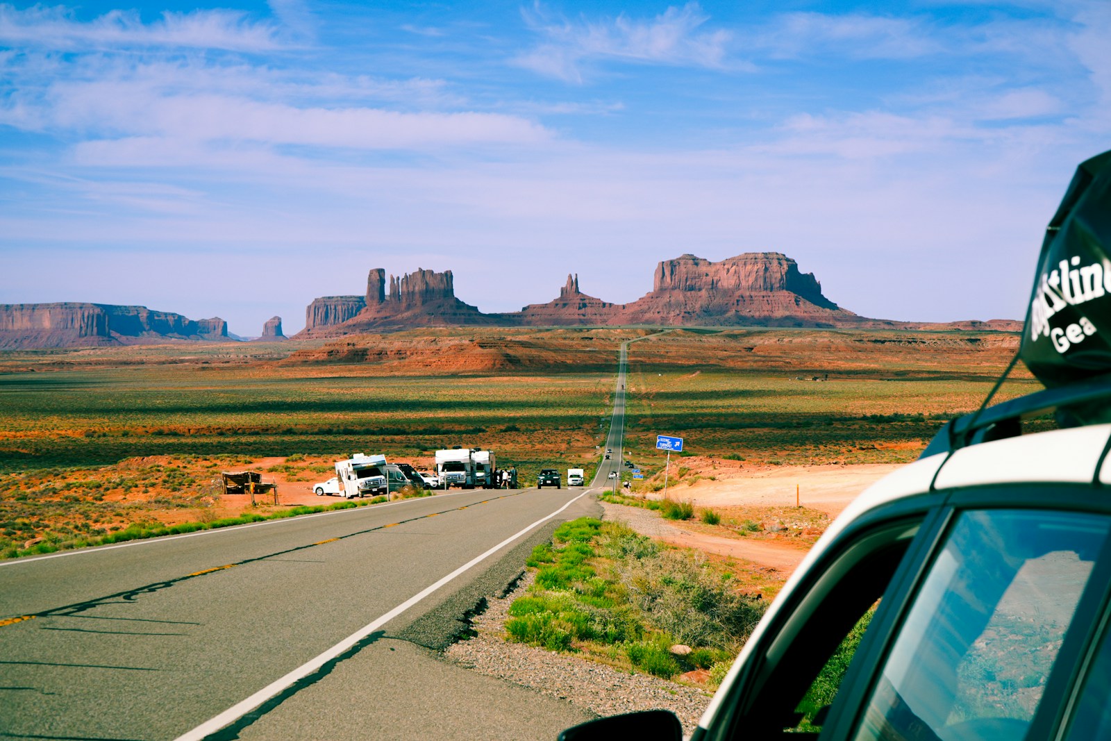
Monument Valley, Arizona · RV-Roundup
Start here
What RV apps actually do for you
You do not need forty apps. You need one for each job you actually do on a trip, and you need to know which ones keep working when the bars disappear.
The short answer
RV apps do four jobs: they find a legal place to park tonight, route you there without sending a 13-foot rig under a 12-foot bridge, show the fuel and dump stations ahead, and warn you about weather along the way. Most RVers settle on five or six. The one thing to understand before you install anything: only a handful of navigation apps account for your rig’s height, weight and length. Google Maps and Waze do not, and no app replaces checking a questionable bridge or campground rule yourself.
For RV-safe routing
RV LIFE
Routes around low clearances, weight limits and propane-restricted tunnels using the dimensions you enter.
For finding a site
Campendium
A usable free tier, and reviews that tell you which carrier had a signal at that exact site.
For knowing your signal
Coverage?
Stores carrier coverage maps on the phone itself, so you can check it in the dead zone you are already in.
For fuel
GasBuddy
Free, covers the US and Canada, and the one fuel app most RVers keep past the first trip.
For weather on the road
Drive Weather
Shows conditions at each point along the drive, and lets you shift your departure time to dodge the worst of it.
For public-land bookings
Recreation.gov
The official federal booking system for national parks and forests. Free app, no middleman.
Side by side
Navigation apps compared
The column that matters most is the second one. Everything else is convenience; that one is clearance.
| App | Routes for RV size? | Platforms | Offline maps | Cost |
|---|---|---|---|---|
| RV LIFE | Yes — height, weight, length and propane-restricted tunnels | iOS, Android, web | Stated by the developer | Subscription, with a free tier |
| Roadtrippers | Yes, on the Premium tier — low bridges, weight and propane limits. US routes only | iOS, Android, web | Not stated | Free tier, paid tiers above it |
| Sygic GPS Truck & Caravan | Yes — height, width, length, weight and trailer count | iOS, Android | Yes, included | Paid, price varies by region |
| CoPilot GPS | Has an RV profile, but recent reviews report it being hidden or removed. Confirm before you rely on it | iOS, Android | Yes, included | Free trial, then subscription |
| inRoute | Partly — clearance and weight. Length and propane handling not confirmed | iPhone, iPad, Mac only | Routes saved on device | Subscription, with a free tier |
| Google Maps and Waze | No. Neither has an RV or truck profile and neither accepts your dimensions | iOS, Android, web | Google Maps only, driving directions only | Free |
Category 1 of 8
Trip planning and RV-safe navigation
An RV-safe router asks for your height, weight and length, then keeps you off roads that cannot take them. A general navigation app never asks, so it never knows.
Read this before you trust a route
Google Maps and Waze do not route for RVs. Neither app offers an RV or truck vehicle profile, and neither lets you enter a height, weight or length. Their route options stop at avoiding tolls and highways. Google has launched restriction-aware routing for large vehicles, but it is sold to developers through its APIs and is not a feature of the Maps app in your pocket. Both are excellent for finding a diner or checking traffic. Neither should pick the road your rig drives down. Even with a true RV router, verify low clearances, weight limits, seasonal closures and campground size limits against the road authority or the campground itself before you commit to a route.
iOS, Android, Web Offline stated Subscription
The most complete RV-safe router
RV LIFE
iOS, Android and a web planner (Trip Wizard) · Free tier; RV LIFE Pro is a paid subscription (checked October 2, 2026)
RV LIFE is the one app on this page built from the ground up around the fact that your vehicle is tall, heavy and long. You enter your rig’s dimensions once and the routing engine keeps you away from low clearances, weight-restricted bridges and propane-restricted tunnels, and it will cap how far you drive in a day if you ask it to. The campground directory and reviews come from the same company’s long-running RV forums, so coverage of private parks is unusually deep. The web-based Trip Wizard is where most people plan; the phone app is what you follow on the day.
What it is good at
- Routes on height, weight, length and propane restrictions
- Day-length limits and toll avoidance built into planning
- Large campground database with member reviews
- Offline navigation and CarPlay/Android Auto listed by the developer
Keep in mind
- GPS routing and Trip Wizard need the paid Pro tier
- Built around the United States and Canada
- You must enter your dimensions accurately for any of it to help
Most useful for: Anyone driving a rig tall or heavy enough that a wrong turn is expensive
iOS, Android, Web Needs signal Free + paid tiers

Best for building the route itself
Roadtrippers
iOS, Android and web · Free tier, with Basic, Pro and Premium paid tiers (checked October 2, 2026)
Roadtrippers is the trip planner people actually enjoy using: drop a start and an end, and it fills the space between with parks, diners, oddities and campgrounds you would never have found. For RVers the important detail is that RV-specific routing, which avoids low bridges and roads with weight or propane restrictions, sits on the Premium tier, and the company states those RV routing features are United States only. This is also where Togo RV ended up: its features were folded into Roadtrippers Premium rather than continuing as a separate app.
What it is good at
- Genuinely good at discovering places along a route
- RV routing on Premium avoids low bridges and weight limits
- Absorbed the Togo RV and Overnight RV Parking features
- Plan on the web, follow on the phone
Keep in mind
- RV routing is Premium only, and the company states it is US only
- The free tier does not include the RV restrictions
- Offline use is not stated by the developer
Most useful for: Trip planners who want the drive to be the point, not just the distance
iOS, Android Offline maps included Paid
Best offline routing for a big rig
Sygic GPS Truck & Caravan
iOS and Android · Paid license or subscription, priced by region · Formerly sold as Sygic Truck & RV Navigation (checked October 2, 2026)
Sygic comes at the problem from the trucking side, which is good news if your rig is genuinely large. You build a vehicle profile with height, width, length, weight and number of trailers, and it routes a commercial-grade road network around what cannot take it. The maps live on your phone, so navigation keeps working deep in a canyon with no bars — the single most useful thing an RV router can do. Note the name: the app has been rebranding from “Truck & RV Navigation” to “GPS Truck & Caravan”, so you may see either depending on your store.
What it is good at
- Full offline maps, no data needed to navigate
- Vehicle profile covers height, width, length, weight and trailers
- Truck-grade restriction data
- Actively updated
Keep in mind
- Pricing varies by region and map license; check before buying
- Handles hazardous-material classes, but propane-tunnel rules specifically were not confirmed
- Interface is built for truckers, not for trip planning
Most useful for: Large fifth wheels and Class A rigs, especially where coverage is poor
iPhone, iPad, Mac Needs signal Subscription
Best for weather-aware route planning
inRoute
iPhone, iPad and Mac only — no Android or web · Free tier, with a Pro subscription (checked October 2, 2026)
inRoute is a multi-stop route planner that thinks about conditions, not just distance: it shows where along the drive you will hit rain, heat or elevation, and optimizes the order of your stops. It accepts RV specifications to help avoid clearance and weight problems, which puts it ahead of any general navigation app — though it is a smart planner that added RV constraints, not a dedicated RV GPS. The Apple-only limitation is the real catch.
What it is good at
- Weather and elevation along the route, not just at the destination
- Accepts RV specs for clearance and weight
- Strong multi-stop optimization
- Routes stored on the device
Keep in mind
- Apple devices only — no Android, no web
- Length and propane-restriction handling not confirmed by the developer
- Full offline map coverage not confirmed
Most useful for: iPhone users planning long multi-stop drives through changeable weather
Category 2 of 8
Campgrounds, RV parks and boondocking
Finding somewhere to sleep splits into three jobs: booking a reservable site, turning up somewhere free, and knowing what the place is really like before you commit the rig to a narrow access road.
iOS, Android, WebOffline coming soon
Campendium
Tens of thousands of listings from paid RV parks to free dispersed sites, with reviews that routinely report which carrier had a usable signal at that exact site — the single most useful field in any campground app. The company lists offline access as coming soon, so do not count on it in a dead zone yet, and trip planning is still web only.
- Reviews report cell signal by carrier
- Free tier is genuinely usable
- Offline access not available yet

iOS, Android, WebOffline maps on PRO
The Dyrt
The largest camping review community in the US, and the offline map download on the PRO tier genuinely works — the developer notes it functions in the app only, not on the website. Trip planning and offline maps sit behind PRO; the free tier is still a solid directory for reading reviews before you book.
- Offline map download on the PRO tier
- Largest camping review community in the US
- Trip planning is PRO only
iOS, Android, WebFree app
Recreation.gov
If you are staying on federal land — national parks, national forests, Army Corps lakes — this is where the reservation actually happens, covering over 3,600 facilities and more than 103,000 individual sites. No middleman and no subscription. Booking and amenity fees still apply, and popular parks release sites on a schedule worth learning.
- Books federal sites directly
- 3,600+ facilities, 103,000+ sites
- Free app; booking fees still apply

iOS, Android, WebNo subscription
Hipcamp
A booking marketplace for camping on private land — farms, ranches, vineyards — alongside public-land listings. There is no subscription; the business runs on the booking. Useful when every public campground within range is full, though sites vary enormously and you should read the access and rig-size notes carefully.
- Private farms, ranches and vineyards
- No membership fee to browse or book
- US, Canada, Australia and the UK
iOS, Android, WebOffline on paid tiers
iOverlander 2
Community-built and genuinely global, which makes it the one to carry if you are heading beyond the US. Coverage of wild camping, water, dump stations and mechanics is maintained by travelers rather than a company. Offline maps and larger downloads sit on the paid tiers; data quality varies by how recently someone passed through.
- The one to carry outside the US
- Wild camping, water and dump stations
- Offline maps on the paid tiers
iOSOffline lookup
Allstays Camp & RV
A directory rather than a planner — Allstays says plainly it is not a trip planner. What it is good at is the stuff other apps skip: low-clearance warnings, truck stops, rest areas and dump stations, held on the device so you can look things up without a signal. Android availability is unclear; the official site describes it as iOS only.
- Low-clearance and bridge warnings
- Looks up without a signal
- A directory, not a trip planner
Category 3 of 8
Memberships and camping discounts
These are subscriptions with an app attached rather than apps you simply download. The maths only works if you camp often enough, and the ownership of several has changed recently.
iOS, Android, WebPaid membership
Harvest Hosts
Overnight stays at farms, wineries, breweries, golf courses and museums. Stays carry no nightly fee, but you are expected to buy something from your host, and you need a self-contained rig. Membership is required to see host details. Harvest Hosts has become a group: it now owns Boondockers Welcome and Escapees too.
- 9,500+ farms, wineries and attractions
- No nightly fee, but buy from your host
- Self-contained rig required
Shares the Harvest Hosts appPaid membership
Boondockers Welcome
Driveway and private-property stays hosted by other RVers, many with electric or water hookups. It still runs as its own brand with its own site and a standalone membership option, but there is no separate app — you search both networks through the Harvest Hosts app. Stays are by host approval, not instant booking.
- Driveway stays hosted by other RVers
- Many hosts offer electric or water
- Shares the Harvest Hosts app
iOSFree app, paid club
Passport America
The long-running half-price camping club, covering parks in the US, Canada and Mexico. The app itself costs nothing and lets you browse; the 50 percent discount needs the paid membership. Individual parks commonly cap how many nights the discount applies to and block it in peak season, so read each listing before you rely on it.
- 50% off at participating parks
- App is free; the club is paid
- Night limits and blackout dates apply

iOS, AndroidFree and paid tiers
Good Sam
The most widely accepted discount card in North America, claiming access to more than 12,500 campgrounds and RV parks. The campground discount needs a paid tier; the free tier earns very little. Worth knowing before you install: the current app has been poorly received in store reviews following a redesign.
- Widest acceptance in North America
- Free, Standard and Elite tiers
- Campground discount needs a paid tier
iOS, AndroidFree app
KOA
Predictable, family-friendly, hookup-equipped campgrounds across the US and Canada — useful precisely because you know what you are getting. The loyalty program is KOA Rewards, which gives ten percent off the daily rate plus points; the old Value Kard name is retired. Book through the app rather than turning up in summer.
- 500+ locations across the US and Canada
- Predictable hookups and amenities
- The program is KOA Rewards

App still branded FMCAPaid membership
Family RV Association
The old Family Motor Coach Association rebranded to the Family RV Association, and its site now describes a community for adventurers of all kinds rather than motorhomes alone. Benefits run to roadside assistance, a magazine and chapter rallies. Note the mismatch: the iOS app is still published under the FMCA name, so search for that.
- Renamed from FMCA in 2024
- Roadside assistance, magazine, rallies
- App is still listed under FMCA
Category 4 of 8
Fuel, dump stations and road services
Diesel and propane are the biggest line in most RV budgets, and a dump station you cannot find is a problem with a deadline. Note how many of these need a signal at exactly the moment you are least likely to have one.
iOS, AndroidNeeds signalFree
GasBuddy
Crowd-sourced fuel prices, and still the one fuel app most RVers keep past the first trip. Prices come from other drivers, so they are usually close but occasionally stale. The separate pay-with-GasBuddy card adds savings at the pump but requires linking a bank account and carries daily and weekly spending caps.
- Crowd-sourced prices, US and Canada
- Free to use
- Prices can be out of date
iOS, AndroidFree to joinNeeds signal
Open Roads
A diesel discount program that genuinely is open to RVers, with a Personal and RV membership tier and no joining fee. Two things to plan around: a physical fuel card is mailed to you and the company says that takes roughly two to three weeks, so enrol well before departure, and there is a daily purchase limit. Diesel rigs only.
- Free to join; RV tier is open
- Physical card mailed in 2 to 3 weeks
- Diesel only, with a daily gallon limit
iOSDatabase on deviceSmall one-off price
RV Dump Stations
The dump-station app worth paying the dollar for, because the location database ships inside the app and works with no signal — which is the entire point when your tanks are full and you are three hours from a town. Listings are community-maintained, so phone ahead for anything that matters, and check seasonal closures in winter.
- Database ships inside the app
- Works with no signal at all
- One-time purchase, no subscription

iOS, AndroidFreeNeeds signal
Love’s Connect
Worth having if you fuel at Love’s, mostly for the shower check-in queue and real-time fuel prices. Travel centers are among the easier places to get a big rig in and out of, with dump stations and propane at many locations. Everything in the app needs a connection, so check what is ahead before you lose service.
- Shower check-in and real-time prices
- Dump stations and propane at many sites
- Needs a connection for everything
iOS, AndroidFreeNeeds signal
Pilot
The Pilot and Flying J network app, renamed from myRewards Plus although the loyalty program kept the myRewards name. Shower reservations, fuel pricing and mobile fuelling, plus the RV-relevant basics of propane and dump stations at many sites. Account required, and nothing in it works without a connection.
- Renamed from myRewards Plus
- Shower reservations and mobile fueling
- Account required
iOSPaid unlock needed
Tollsmart
Calculates tolls for a route, which matters because an RV or a truck towing a car is charged by axle count and can pay several times the car rate. The catch to budget for: the free version prices two-axle passenger vehicles only, and multi-axle support — up to nine axles including trailers and RVs — sits behind a paid unlock.
- Prices tolls along your route
- Free tier covers two-axle vehicles only
- Multi-axle needs the paid unlock
Category 5 of 8
Internet, cell coverage and staying connected
If you work from the road, or just want to know whether anyone can reach you tonight, this is the category that decides where you park. One app here works without a signal, which is the only kind that helps once you have lost one.

iPhone, iPad, MacFully offlinePaid
Coverage?
The standout in this list, because the carrier coverage maps are compressed and stored inside the app — so you can check whether the next valley has service while standing in one that does not. Overlay and compare carriers before committing to a week-long stay. Canadian carrier maps are a separate unlock, and it is Apple-only.
- Carrier maps stored on the phone
- Overlay and compare carriers
- Apple devices only
iOS, AndroidFree with subscriptions
WiFi Map
A crowd-sourced map of public WiFi hotspots and their passwords, now repositioned around selling eSIM data and a VPN. Useful as a backup when you need to upload something large from a town. Two honest caveats: hotspot passwords are community-submitted and often wrong, and the offline map regions sit behind a subscription.
- Crowd-sourced hotspots and passwords
- Offline regions need a subscription
- Passwords are often wrong
iOS, AndroidFreeNeeds signal
Speedtest by Ookla
The quickest way to find out whether the park WiFi you were promised is real, and whether your hotspot can carry a video call before you commit to a meeting. Run it at the site, not at the office. Its crowd-sourced coverage maps are built from other people’s test results and are not a substitute for a carrier coverage map.
- Tests what the connection really does
- Free with ads
- Its maps are test results, not coverage
iOSFree
Antenna Point
If you still watch over-the-air television, this shows which broadcast towers are near your site, how far away they are and which direction to aim at, which saves a lot of guessing on the roof. Note the name — it is Antenna Point, not Antenna Pointer — and the app has not been updated in a couple of years.
- Shows broadcast towers and bearing
- Free, from Antennas Direct
- Not updated in a couple of years
Category 6 of 8
Weather, safety and health on the road
A thunderstorm is a different problem in a high-sided vehicle than it is in a car, and medical care is harder to arrange when you are three states from your own doctor.
iOSNeeds signalFree with paid tiers
Drive Weather
The most directly useful weather app for driving, because it forecasts conditions at each point along your route and at the time you will actually be there — then lets you shift your departure to miss the worst of it. Includes radar and road-condition reports. High crosswinds matter more to a tall rig than rain does; plan around them.
- Forecast at each point along the route
- Shift departure to miss the worst
- Crosswinds matter more than rain
iOS, AndroidNeeds signalPaid
RadarScope
Professional-grade radar aimed at storm spotters and meteorologists, showing raw NEXRAD data rather than a simplified graphic. Worth it if you camp through convective season and want to judge a storm yourself rather than wait for an alert. It has a genuine learning curve and is overkill for casual use.
- Raw NEXRAD radar, not a simplified graphic
- Built for spotters and meteorologists
- Steep learning curve

iPhone, iPad, MacFully offlinePaid
State Lines
A reference for how state law changes as you cross a border — the rules that vary by state and catch travelers out. The whole database sits on the phone and works with no connection, and its 2026 update re-verified every field. As the developer says, laws change: treat it as a prompt to check, not as legal advice.
- Whole database stored on the device
- Every field re-verified in 2026
- A prompt to check, not legal advice
iOS, AndroidFreeNeeds signal
FEMA
Official National Weather Service alerts plus disaster-preparedness checklists and shelter locations. One limitation matters for a moving RV: alerts are based on saved ZIP codes, up to five locations, rather than tracking where you actually are, and the app states it does not offer real-time location-based tornado alerts.
- Official National Weather Service alerts
- Shelter and recovery centre locations
- ZIP-code based, up to five locations
iOSFree
Emergency by American Red Cross
Severe-weather alerts, a shelter locator and plain-language guidance for more than a dozen emergency types, in English and Spanish. No account needed for basic alerts. Note the rename, and that the current release requires a fairly recent iOS version, which rules out older phones kept as backups.
- Alerts plus plain-language guidance
- English and Spanish
- Needs a recent iOS version
iOS, AndroidFree appNeeds signal
Telehealth and prescriptions
Teladoc and Doctor On Demand both offer video visits without needing a local doctor, and Teladoc states insurance is not required for many services. Doctor On Demand kept its name after its parent became Included Health. GoodRx compares prescription prices across US pharmacies — save or screenshot the coupon before you lose signal at the counter.
- Video visits without a local doctor
- Teladoc: insurance not always required
- Save GoodRx coupons before losing signal
Category 7 of 8
Trails, parks and traveling with pets
What you actually came for, plus the dog in the passenger seat. Several of these are the rare apps that keep working once you walk away from the rig and lose signal.
iOS, AndroidOffline downloadFree
National Park Service
The official app for every national park unit, and the free offline download is the standout feature: maps, self-guided tours, amenities and alerts saved to your phone before you lose service at the entrance gate. Download the park before you arrive, because the visitor center parking lot is frequently where the bars run out.
- Free offline download for each park
- Maps, tours, amenities and alerts
- Download before the entrance gate

iOS, AndroidOffline on paid tiersFree with paid tiers
AllTrails
The biggest trail database, with filters that matter when you are traveling with a dog, a stroller or limited mobility. Downloading a map for offline use needs a paid tier, which is worth it before any hike where the trailhead has no service. Trail conditions come from other users, so recent reviews beat the stated difficulty.
- Filters for dogs, strollers and access
- Offline maps on the paid tiers
- Trust recent reviews over difficulty
iOS, AndroidOffline core featureSubscription
Gaia GPS
Serious backcountry mapping with layered topographic, satellite and public-land ownership maps, all downloadable for offline use. The land-ownership layers are genuinely useful for working out whether dispersed camping on a given track is legal. The developer markets it for RV travel precisely because it works far from cell service.
- Layered topographic and satellite maps
- Public land ownership layers
- Offline is the central feature
iOS, AndroidOffline mapsSubscription
onX Offroad
Built for forest roads and trails rather than highways, with public and private land boundaries and offroad trail data. If you are towing something small down a forest service road to a dispersed site, this is the app that tells you whose land you are on. It is not a substitute for an RV-safe router on paved roads.
- Forest roads and offroad trails
- Public and private land boundaries
- Not a paved-road RV router
iOS, AndroidFreeOn-device model
Seek by iNaturalist
Point your camera at a plant, insect or animal and it identifies it using a model stored on the phone. It requires no registration and collects nothing by default, which makes it the easiest thing on this page to hand to a child at a campground. Its sibling iNaturalist, for contributing real research observations, now ships as a rewritten app.
- Identifies species using an on-device model
- No account, collects nothing by default
- Easy to hand to a child at camp
iOS, AndroidFree appsNeeds signal
Traveling with a dog
BringFido finds pet-friendly campgrounds, restaurants and attractions, and is worth checking before booking anywhere with a breed or weight policy. Barkio turns two phones into a pet monitor over your local network for when you leave the dog in the rig. The Red Cross Pet First Aid app covers everyday emergencies and locates an emergency vet.
- BringFido finds pet-friendly places
- Barkio turns two phones into a pet monitor
- Red Cross Pet First Aid for emergencies
Category 8 of 8
Food, local finds and downtime at camp
What you do once the levelers are down: finding dinner, finding the strange roadside thing two exits back, and filling a rainy afternoon when the antenna finds nothing.

iOS, AndroidOffline toursPay per tour
GuideAlong
GPS-triggered audio tours that play automatically as you drive through a national park or along a scenic route, telling you what you are looking at without anyone needing a signal. The developer states tours work offline once downloaded, which is the whole point in a park with no coverage. Download before you reach the gate.
- Tours play automatically by GPS
- Works offline once downloaded
- Pay per tour or by bundle
iOS, AndroidOffline modeSubscription
Autio
Location-triggered short stories about the places you are driving past — history, music, local characters — from a large and well-produced library. It has an offline mode for downloading stories before heading somewhere remote, which the developer notes it is still improving. Good for the long empty stretches where the radio gives up.
- Location-triggered short stories
- Offline mode for remote stretches
- Renamed from HearHere
iOSPaid by region
Roadside America
The long-running guide to roadside oddities: the giant fibreglass animals, the strange museums, the world’s largest whatever. Still hand-curated by its founders, and in 2026 they added a dedicated Route 66 app. Worth clearing up a common confusion: the Roadside America tourist attraction in Pennsylvania closed in 2020, but the app and website are very much alive.
- Hand-curated roadside oddities
- A dedicated Route 66 app arrived in 2026
- iOS only, no Android version
iOS, AndroidNeeds signalFree and paid
Yelp and HappyCow
Yelp remains the fastest way to find out whether the only diner in town is any good, and its photos often reveal whether the parking lot can take your rig. HappyCow is the specialist equivalent for vegan and vegetarian food, covers the whole world, and lets you save favorites for offline access, which helps when planning a route through thin country.
- Yelp photos show whether the lot fits a rig
- HappyCow saves favorites for offline use
- HappyCow is a one-time purchase
iOS, AndroidDownloads supportedSubscription
Audible and Spotify
The two that make a long driving day disappear. Both officially support downloading so you can listen with no signal, which is the only thing that matters out west. One Spotify detail worth knowing before a long boondocking stretch: downloads need the app to go online at least once every thirty days or they stop playing.
- Both officially support offline downloads
- Spotify needs to go online every 30 days
- Both are subscriptions
iOS, AndroidStreaming onlyFree and paid
Tubi, Pluto TV and Sling
Tubi and Pluto TV are free, ad-supported and perfectly adequate for a rainy evening; Sling is the paid option if you want live channels, and it sells a day pass that suits intermittent use better than a monthly plan. None of the three advertise offline downloads, so all of them need a connection good enough to stream — test the park WiFi first.
- Tubi and Pluto TV are free with ads
- Sling sells a day pass for occasional use
- None of them advertise offline downloads
Corrections
What changed since the last RV app roundup
Most RV app lists on the internet are quietly out of date. These are the changes we found when checking each app against its own publisher, and the reason several familiar names are missing above.
Togo RV
Merged into Roadtrippers. togorv.com now redirects to a Roadtrippers page stating Togo RV is integrated into Roadtrippers Premium. The standalone app has not been updated since early 2024. Use Roadtrippers Premium instead.
FMCA is now the Family RV Association
The organization rebranded in 2024 and fmca.com redirects to frva.com. Confusingly, its mobile app is still published under the FMCA name, so search for FMCA if you want the app.
Escapees RV Club
Acquired by Harvest Hosts in July 2024. Escapees still runs its own site and brand, but Harvest Hosts states the membership is being integrated into its platform, and the two official sources do not fully agree on what is standalone today.
Sygic Truck & RV Navigation
Renamed to Sygic GPS Truck & Caravan. It is the same app and the same listing; the old name may still show depending on your store region.
FreeRoam
Appears to be gone. Its domain no longer resolves and we found no current App Store or Google Play listing. We found no formal shutdown notice, so treat the exact status as unconfirmed, but do not plan around it.
Oh, Ranger! ParkFinder
Still downloadable, but last updated in 2019. Its own publisher now promotes a different app. We have dropped it in favour of the official National Park Service app.
GyPSy Guide and HearHere
Both renamed: GyPSy Guide is now GuideAlong, and HearHere is now Autio. Both are actively maintained — only the names changed.
Thousand Trails and boondocking.org
Thousand Trails has no current app of its own; the related CampUSA app was last updated in 2022. Separately, boondocking.org is now a parked domain listed for sale — freecampsites.net is the live free-camping directory, though it offers a website and an Android app rather than an iOS app.
Before you go
Getting your apps ready for the trip
An app you installed in the driveway and never opened is not much use at a trailhead with no signal. Half an hour of setup at home prevents most of the problems.
Download everything while you are on real WiFi
Offline maps, national park content, audio tours, audiobooks and playlists all need to be pulled down before you leave a good connection. The campground WiFi you were promised is rarely up to it, and the moment you need a map is usually the moment you have no bars.
Set up accounts and cards weeks ahead
Several of these are not instant. Fuel discount programs mail a physical card — Open Roads says roughly two to three weeks — and membership clubs need payment set up before the discount works. Sort them at home, not in a fuel lane.
Know which apps die without a signal
Most of this list needs data. Before a remote stretch, check that your routing, campground and coverage apps have their offline data downloaded, and assume anything involving live prices, bookings or streaming will simply stop working.
Pre-departure app checklist
- Enter your rig’s real height, length and weight into your routing app — including the air conditioner
- Download offline maps for every state you will cross
- Download each national park’s content in the NPS app before you arrive
- Save or screenshot membership cards, discount codes and reservation confirmations
- Enrol in any fuel program that mails a physical card, several weeks ahead
- Download audiobooks, playlists and audio tours while on home WiFi
- Check carrier coverage along the whole route, not just at the destination
- Confirm rig-length limits and road access with the campground directly
Questions
RV app questions, answered
The things RVers most often get wrong about apps, including the one that can genuinely damage a rig.
Keep reading
More RV resources
Best RV Magazines: Print, Digital & Free Options
Every RV magazine still worth reading, sorted by how you get it — paid print, club titles, free digital and the trade press.
All RV Resources
Guides, clubs, books and reference material for planning and living the RV life.
How we checked this page
Every app on this page was checked on October 2, 2026 against the developer’s own website and its official Apple App Store or Google Play listing, rather than against other articles. We recorded the current app name, whether it is still available, which platforms it supports, its pricing model and whether the publisher states that it works offline. Where a detail could not be confirmed from an official source — several membership prices, and Android availability for a number of these apps — we have said so in the entry rather than repeating a figure we could not verify. We do not publish prices, ratings or download counts we have not seen on an official page, and we have not personally tested every app listed here.
App features, pricing and availability change frequently, and prices vary by region. Treat everything here as a starting point and confirm on the developer’s own page before you subscribe. No app — including the RV-safe routers above — removes your responsibility to verify routes, bridge clearances, weight and length limits, seasonal road closures, campground rules and rig-size restrictions with the road authority or the campground itself before you travel.