Things to Do in Arizona
Arizona has two seasons for getting out: cool pine country up high in summer and warm desert sun down low in winter. Use the map to pick an area, then open its guide for hours, fees and RV parking tips.
Arizona · Grand Canyon State
Areas
15 on the map
5 with guides so far
Attraction guides
30
Flagstaff, Sedona, Lake Havasu, Quartzsite & Yuma
Elevation
70–12,633 ft
Desert to alpine
Seasons
Year-round
High country in summer, desert in winter
Updated October 31, 2026 · Each guide covers hours, admission and RV parking
Pick your area
Explore Arizona by area
Choose an area to see when to go and what’s there. Areas with guides link straight to their attractions, and more are on the way.
Guides availableComing soon
Summer escape
Flagstaff
A volcano, cliff dwellings and a lava tube cave within about 30 minutes of town, plus the Snowbowl scenic lift and Bearizona’s drive-thru in nearby Williams.
See things to do in FlagstaffRim trails, viewpoints and ranger programs at the South Rim, which is open all year and busiest in summer. Tusayan and Williams are the closest gateway towns.
Houseboats and paddling on Lake Powell, with Horseshoe Bend and Antelope Canyon tours close by.
A Navajo Nation tribal park with a scenic loop drive. Check the tribal park’s rules and hours before you go.
A volcano, cliff dwellings and a lava tube cave within about 30 minutes of town, plus the Snowbowl scenic lift and Bearizona’s drive-thru in nearby Williams.
Red rock hikes to Cathedral Rock and Devil’s Bridge, the natural water slide at Slide Rock, jeep tours and sunrise balloon flights.
A courthouse-square downtown, granite lakes and pine forest, with milder summers than the valley.
A classic stretch of historic Route 66 and a handy stop between Las Vegas and the Grand Canyon.
The relocated London Bridge, replica lighthouses along the shore, a wildlife refuge on the Colorado River and sunset boat tours.
Desert history at Hi Jolly’s Tomb and the Quartzsite Museum, Palm Canyon in the Kofa refuge and miles of OHV trails on the Arizona Peace Trail.
Desert hikes, museums, botanical gardens and spring training baseball, best in the cooler months. July highs average around 107°.
Pine country below the Mogollon Rim, about 90 minutes from Phoenix, with lakes and forest camping.
Show Low, Pinetop-Lakeside and Greer: high lakes, trout fishing and cool summer nights.
Saguaro National Park, the Arizona-Sonora Desert Museum and the scenic drive up Mount Lemmon.
Old mining towns, Kartchner Caverns and birding in the sky islands of southeast Arizona.
Yuma Territorial Prison, riverside parks on the Colorado, the Telegraph Pass hike, a Castle Dome ghost town and a Medjool date farm.
Latest guides
Newest things-to-do guides
Full guides with hours, admission, time needed, RV parking and what’s nearby.
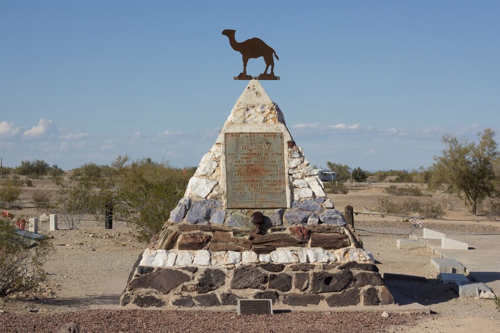
Hi Jolly’s Tomb
A stone pyramid with a metal camel on top marks the grave of Hadji Ali, the U.S. Army camel driver everyone called Hi Jolly, in Quartzsite’s old cemetery.
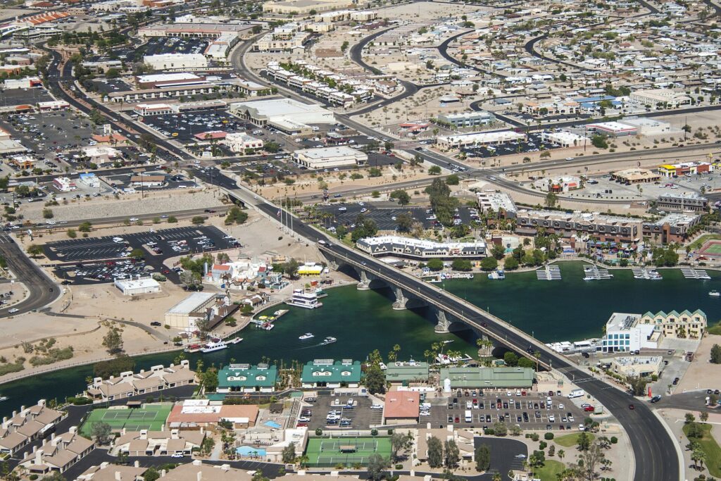
London Bridge
Walk across the 1831 granite bridge that was bought at auction in London, shipped to Arizona and rebuilt over a desert channel, then stay for the waterfront and the lights after dark.
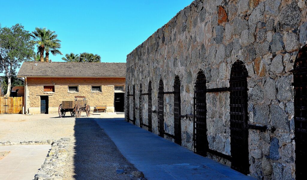
Yuma Territorial Prison State Historic Park
Walk the 1876 stone cellblocks, step into the Dark Cell and climb the guard tower at Arizona Territory’s first prison, just off I-8 above the Colorado River.
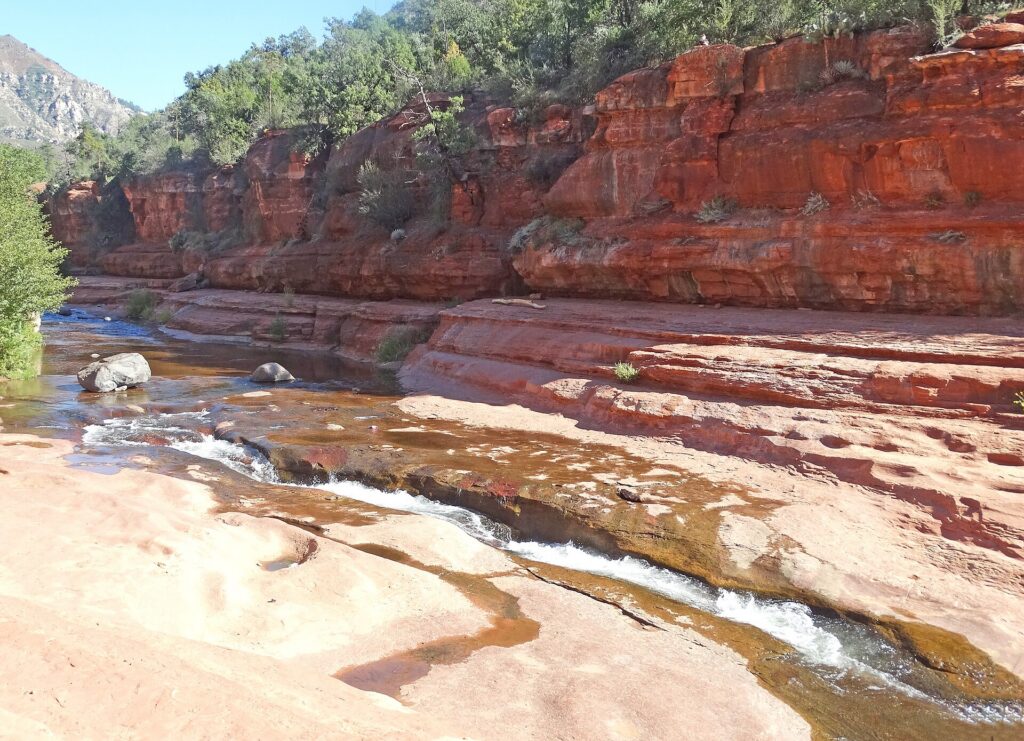
Slide Rock State Park
Slide down an 80-foot natural chute in Oak Creek, wade the cold pools below red canyon walls, and stroll a 1912 apple homestead on paved paths.
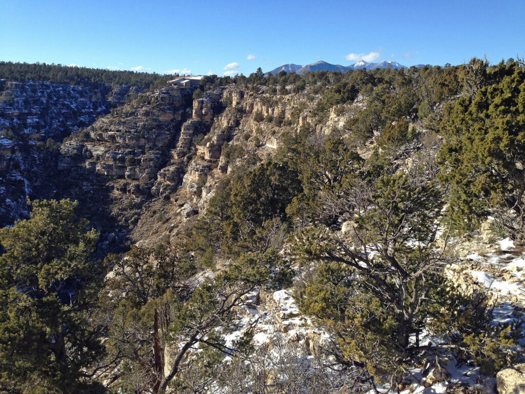
Walnut Canyon National Monument
Walk the Island Trail past 25 cliff dwelling rooms built between 1125 and 1250, then stroll the easy Rim Trail, about 7.5 miles east of Flagstaff off I-40.
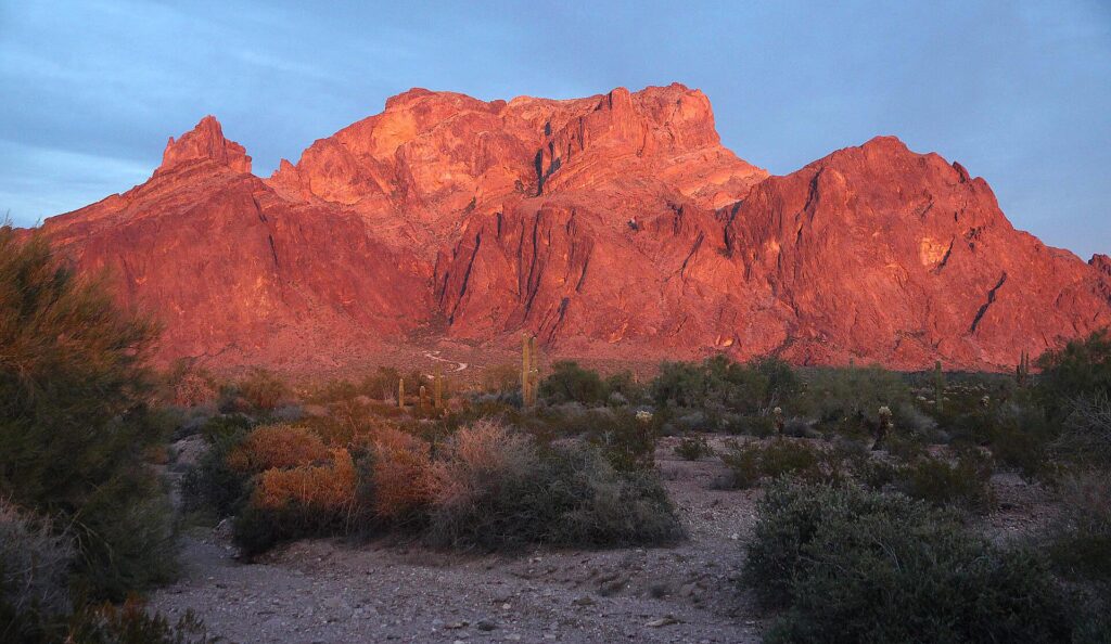
Palm Canyon Trail
A short, rocky trail into a volcanic canyon in the Kofa Mountains, where a hidden grove of California fan palms, possibly Arizona’s only native palms, grows in a side canyon.
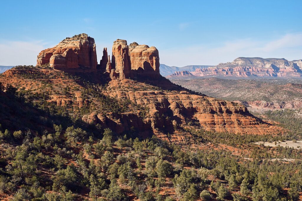
Thank you to the people behind these photos. Please support them by giving their work a look. Photos: Hi Jolly’s Tomb: sonora ortiz on Wikimedia Commons (CC BY-SA 4.0); London Bridge: S. Winkvist on Wikimedia Commons (CC0); Yuma Territorial Prison State Historic Park: Scotwriter on Wikimedia Commons (CC BY-SA 3.0); Slide Rock State Park: Don Graham on Wikimedia Commons (CC BY-SA 2.0); Walnut Canyon National Monument: Fredlyfish4 on Wikimedia Commons (CC BY-SA 3.0); Palm Canyon Trail: Astrobirder-isopods on Wikimedia Commons (CC BY-SA 4.0). Cathedral Rock header photo: Nikolai Gates Vetr on Wikimedia Commons (CC BY-SA 4.0). Map outline from the U.S. Census Bureau; roads from OpenStreetMap contributors.
Disclaimer
RV-Roundup is an independent, community-based resource created to help RV travelers and to support and promote the places we feature. RV-Roundup is not owned by, operated by, or officially affiliated with the attractions, businesses or areas listed on this page unless otherwise stated.
The information on this page was prepared using the most current details available at the time of publication, including each attraction’s published materials and publicly available sources. Seasons and elevations are general guides; pricing, availability, rules, policies, amenities and other details are set by each attraction or operator and may change at any time without notice. Before you travel or book, please confirm all details directly with the attraction. RV-Roundup is not responsible for errors, omissions, or changes made after publication. The map is approximate and not for navigation.
We will always do our best to keep this page up to date. Thank you to everyone who contributes; we truly appreciate your help and support.