
Yuma · Gila Mountains above the Fortuna Foothills · Desert hike
Telegraph Pass Trail
A short, very steep climb up a concrete tower road in the Gila Mountains, with big views over Yuma, the Foothills and the farm fields beyond.
Opens the trailhead in Google Maps. There’s no official trail page, so start early and carry more water than you think you need.
Details checked October 2026
Type
Desert summit hike
Wash, dirt road, then a steep concrete road
Admission
Free
No fee or permit found
Hours
No posted hours
Go at sunrise; skip hot afternoons
Time needed
About 3 hours
Round trip, per HikeArizona hiker reports
Parking
Dirt lot, road’s end
Cars and tow vehicles; no room for rigs
Towers at
1,720 ft
Up from about 535 ft at the trailhead
What you’ll see
A steep climb with a big Yuma view
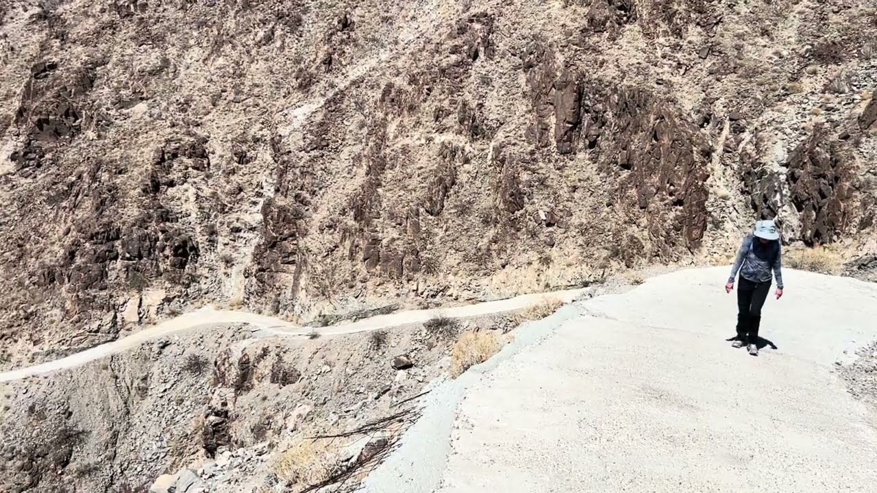
The first stretch follows a desert wash and dirt road; the second half climbs a rough concrete road to the towers.
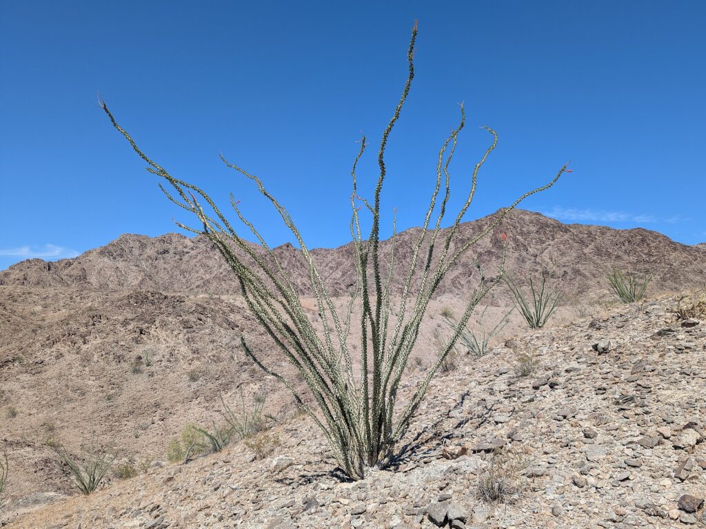
Photo: Krzysztof Ziarnek, Kenraiz on Wikimedia Commons (CC BY-SA 4.0)
Summit views
The view from the towers
From the ridge you look out over the farm fields north of the Gila Mountains, the Fortuna Foothills below and I-8 running west toward downtown Yuma. Views are what Google reviewers mention most, and sunrise is a favorite time to be on top.
RV tip: unhook and drive the tow car; the trailhead is a small dirt lot at a dead-end road.
More to see
- The wash approachThe first part follows a dry desert wash and a dirt road before the real climbing starts.
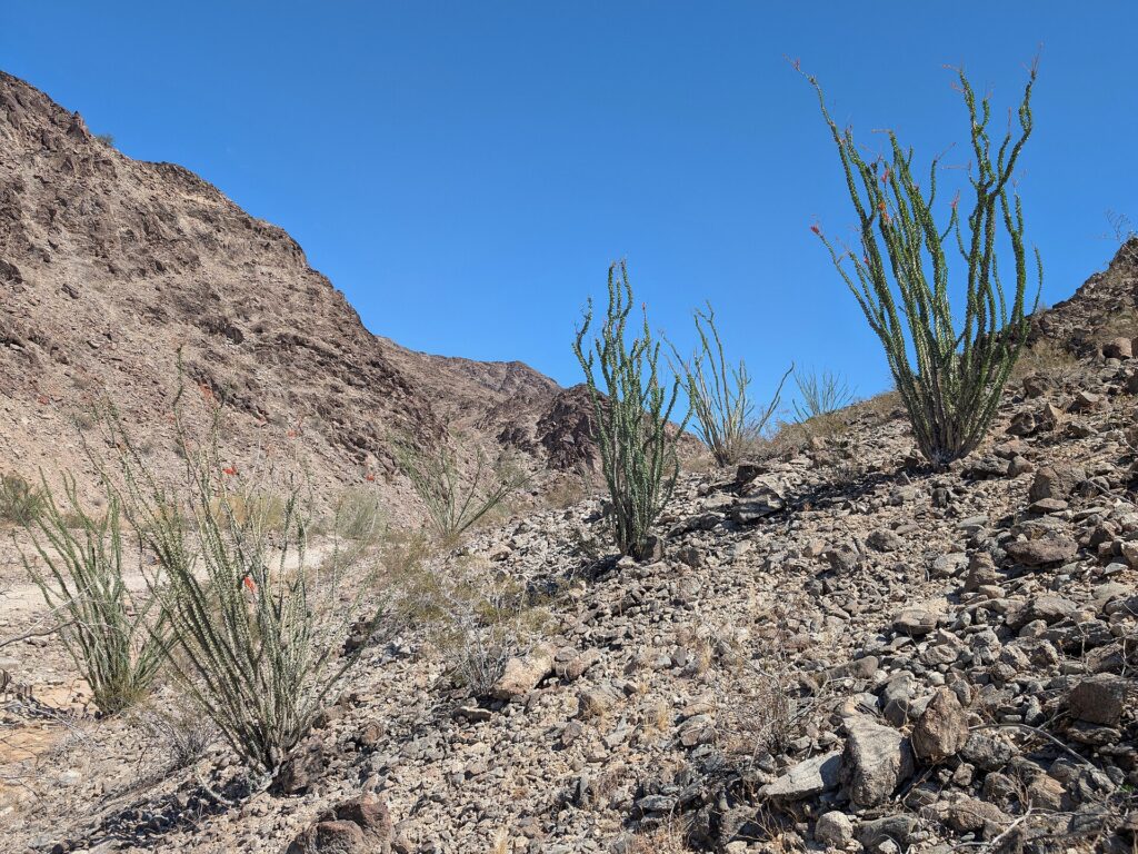
- Spring bloomIn a good year, ocotillo and other desert plants bloom from late winter into spring.
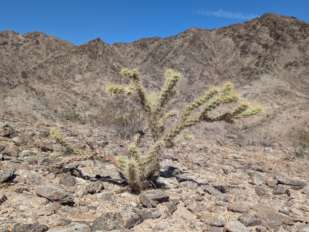
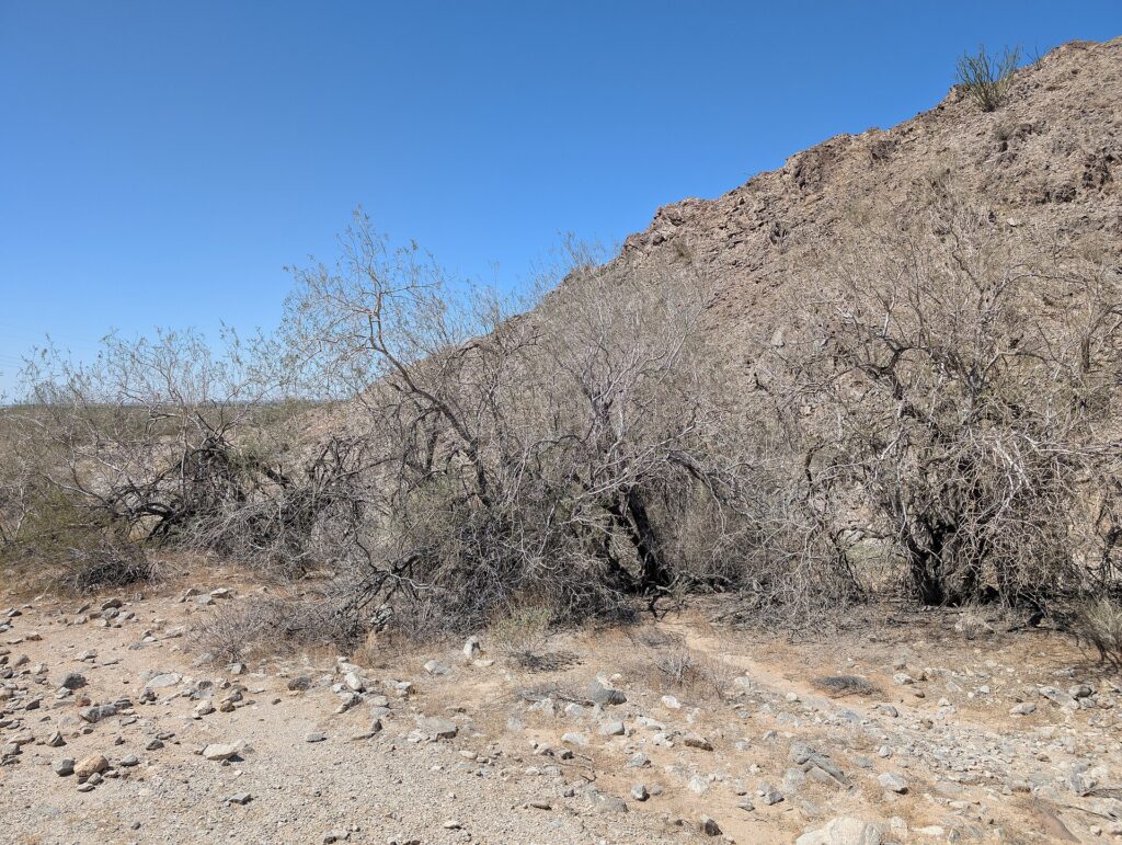
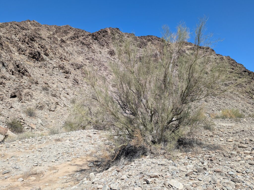
- Desert treesLook for foothill palo verde, desert ironwood and buckhorn cholla on the rocky slopes.
- The true high pointPast the towers, the true high point at about 1,760 feet takes a short rock scramble. Skip it if you’re not sure-footed.
Why go
Yuma’s favorite workout hike
Telegraph Pass is a ridge in the Gila Mountains just east of the Fortuna Foothills, topped by communication towers. The route follows a dry wash and a dirt road, then climbs a narrow, rough concrete service road to the towers at about 1,720 feet.
Round trip is about 5 miles with roughly 1,100 to 1,300 feet of climbing, depending on whose numbers you use. The concrete section is the steep part, with grades of 35 percent or more, and Google reviewers talk about the climb almost as often as the view.
Go from late fall to early spring and start at dawn. There’s no shade and no water on the route, and Yuma summers can top 110 degrees. Take the descent slowly; the steep concrete and loose gravel are where people slip.
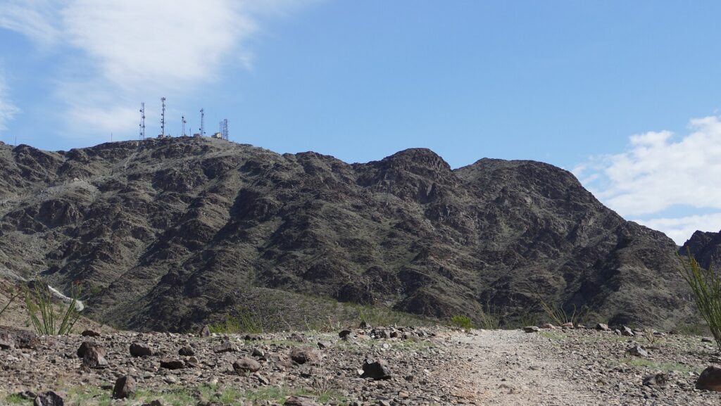
Photo: Ragnar76149 on Wikimedia Commons (CC BY-SA 4.0)
Why it made our list
- Free, with no permit found
- Big views over Yuma and the Foothills
- A real workout in a morning
- About 11 minutes from Westwind RV & Golf Resort
- Rated 4.7 on Google by 429 hikers
For RVers
Hiking Telegraph Pass from your RV park
The practical stuff we wished someone had told us before we pulled in.
Find the right Telegraph Pass
Phoenix’s South Mountain Park has its own Telegraph Pass Trail, so double-check your map. Yuma’s trailhead is at the east end of the I-8 North Frontage Road, about 3 miles east of the Foothills Boulevard exit.
Small dirt lot, no big rigs
Parking is a dirt area where the frontage road ends. We found nothing about room for RVs or a turnaround, so drive the tow vehicle. Arrive early on cool weekend mornings, when the trail is popular.
Dogs and hot concrete
No official pet rule is posted. Reviewers say they’ve hiked with dogs, but the steep, sun-baked concrete is hard on paws. Go only on cool mornings and carry water for your dog.
No shade, so start at dawn
There’s no shade and no water on the trail. Hike from late fall to early spring, start at first light, carry more water than you think you need, and wear shoes with good grip for the way down.
What visitors say about Telegraph Pass Trail
The visitor report card
We don’t copy other sites’ reviews, but the published scores are worth reading together. Scores checked October 4, 2026.
The best view in Yuma
Yuma Sun, in a column headline · yumasun.com



What visitors often mention
Recurring topics in Google’s review highlights
ViewsSteep climbSunrise hikes
Google’s review topics point to the views (21 reviews), how steep it is (12 mention the steepness and 12 the climb) and sunrise hikes (5). Checked October 4, 2026.
How high you’ll climb
Elevations from hiker sources HikeArizona (trailhead) and Surgent’s Mountains of Arizona (towers and high point), not an official survey.
Good to know
CostFree
PermitNone found per HikeArizona
RestroomsPorta-potties mentioned by reviewers
BringPlenty of waterSun hatGrippy shoes
We found no official trail page with fees, hours or facilities. Trail figures come from hiker sites HikeArizona and Surgent’s Mountains of Arizona, checked October 4, 2026.
Know before you go
Plan your visit
Telegraph Pass Trail
- AddressEast end of the I-8 North Frontage Rd., Yuma, AZ 85367
- HoursNo posted hours
Go at sunrise; skip hot afternoons - PhoneNone; we found no official trail page
- CostFree · no permit found
- Getting thereFrom downtown Yuma, take I-8 east to the Foothills Boulevard exit, go north briefly, then turn right on the North Frontage Road and follow it about 3 miles to its end.
- ParkingA dirt parking area at the end of the frontage road. Bring the tow vehicle or car, not the RV.
No hours are posted. Go at sunrise from late fall to early spring, and skip hot afternoons; there’s no shade or water on the trail.
Where to stay nearby
RV parks near Telegraph Pass Trail
We haven’t written up Yuma’s RV parks yet, so here are three well-reviewed resorts, all adult communities, with drive times to the trailhead.
About 11 min · 5.9 mi via the I-8 frontage roads
Westwind RV & Golf Resort
55+ resort on East 32nd Street with its own golf course, a heated pool and spa, pickleball, and a restaurant and bar.
About 13 min · 8.8 mi via I-8 E
Sun Vista RV Resort
55+ resort on East 32nd Street since 1984, with 30- and 50-amp full hookups, indoor and outdoor heated pools, and pets welcome.
About 33 min · 23.7 mi via I-8 E
Cocopah Bend RV & Golf Resort
Adult RV community by the Colorado River on Yuma’s west side, with an 18-hole golf course, pickleball and a 2.5-acre pet exercise area.
Helpful answers
Frequently asked questions
The questions RVers ask most before pulling in.
Best Nov–Apr · start at sunrise
Climb Telegraph Pass at sunrise
Drive the tow car to the end of the frontage road, pack plenty of water, and take the descent slowly.
Thank you to the people behind these photos and this video. Please support them by giving their work a look. Photos via Wikimedia Commons: Krzysztof Ziarnek, Kenraiz (trail plants; CC BY-SA 4.0) and Ragnar76149 (the towers; CC BY-SA 4.0); the images were resized. Video: Joe Stasey on YouTube. Review-site logos are trademarks of their owners.
Disclaimer
RV-Roundup is an independent, community-based resource created to help RV travelers and to support and promote the places we feature. RV-Roundup is not owned by, operated by, or officially affiliated with Telegraph Pass Trail unless otherwise stated.
The information on this page was prepared using the most current details available at the time of publication, including hiker reports and publicly available sources. Trail conditions, access and other details may change at any time without notice, and we found no official trail page for Telegraph Pass Trail, so check current conditions before you go and hike within your limits. RV-Roundup is not responsible for errors, omissions, or changes made after publication.
We will always do our best to keep this page up to date. Thank you to everyone who contributes; we truly appreciate your help and support.